


Logan Township Voting District, Butler County, Kansas
About
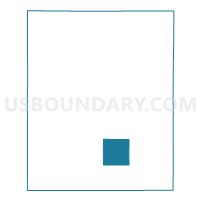
Outline

Summary
| Unique Area Identifier | 584103 |
| Name | Logan Township Voting District |
| County | Butler County |
| State | Kansas |
| Area (square miles) | 36.27 |
| Land Area (square miles) | 36.24 |
| Water Area (square miles) | 0.03 |
| % of Land Area | 99.91 |
| % of Water Area | 0.09 |
| Latitude of the Internal Point | 37.60681780 |
| Longtitude of the Internal Point | -96.78954660 |
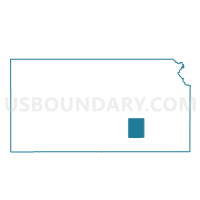
Maps

Graphs
Select a template below for downloading or customizing gragh for Logan Township Voting District, Butler County, Kansas


Neighbors
Neighoring Voting District (by Name) Neighboring Voting District on the Map
- Bloomington Township Voting District, Butler County, KS
- Clay Township Voting District, Butler County, KS
- Glencoe Township Voting District, Butler County, KS
- Hickory Township Voting District, Butler County, KS
- Little Walnut Township/Leon Voting District, Butler County, KS
- Rock Creek Township Voting District, Butler County, KS
- Spring Township Voting District, Butler County, KS
- Union Township/Latham Voting District, Butler County, KS
Top 10 Neighboring County Subdivision (by Population) Neighboring County Subdivision on the Map
- Spring township, Butler County, KS (1,487)
- Little Walnut township, Butler County, KS (1,044)
- Bloomington township, Butler County, KS (535)
- Rock Creek township, Butler County, KS (325)
- Glencoe township, Butler County, KS (202)
- Union township, Butler County, KS (184)
- Logan township, Butler County, KS (122)
- Hickory township, Butler County, KS (74)
- Clay township, Butler County, KS (70)
Top 10 Neighboring Unified School District (by Population) Neighboring Unified School District on the Map
Top 10 Neighboring State Legislative District Lower Chamber (by Population) Neighboring State Legislative District Lower Chamber on the Map
Top 10 Neighboring State Legislative District Upper Chamber (by Population) Neighboring State Legislative District Upper Chamber on the Map
Top 10 Neighboring 111th Congressional District (by Population) Neighboring 111th Congressional District on the Map
Top 10 Neighboring Census Tract (by Population) Neighboring Census Tract on the Map
- Census Tract 201, Butler County, KS (6,253)
- Census Tract 209.01, Butler County, KS (4,144)
- Census Tract 209.03, Butler County, KS (3,652)